Belgium’s wettest landscape became its largest recorded wildfire
A wildfire that started near Baelen on 14 August burned about 3,000 hectares of the High Fens after prolonged dry weather turned surface vegetation and peat into fuel.
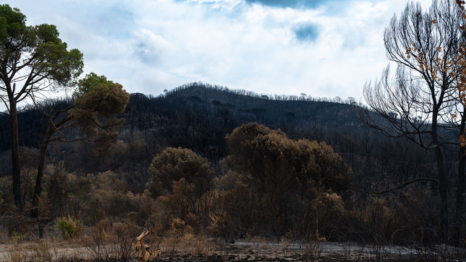
In 30 seconds
- The fire started near Baelen at approximately 13:06 on 14 August 2026.
- Authorities estimated the affected area at about 3,000 hectares.
- Almost 500 responders and more than 120 vehicles were deployed at the operation’s peak.
- Two firefighters were treated for carbon-monoxide exposure and were reported stable.
Updated 24 August 2026 (CEST) — A wildfire broke out near in at about 13:06 on 14 August and burned roughly 3,000 hectares of the , according to the Walloon government and the governor of Liège province. Authorities subsequently contained the fire, but Belgium’s Defence Ministry said on 19 August that final work to secure its perimeter was continuing.
The scale makes this Belgium’s largest recorded nature fire, surpassing the roughly 1,200-hectare High Fens fire of April 2011, according to Walloon government records. At the height of the operation, the governor’s office reported that almost 500 responders and more than 120 vehicles were deployed. Belgian crews received support from Luxembourg, the Netherlands and Sweden, while Belgian Defence supplied military firefighters and six Panther fire engines.
The apparent contradiction — a major fire in Belgium’s wettest region — lies in the landscape itself. The Royal Meteorological Institute describes the High Fens as Belgium’s rainiest area, but also notes that serious fires can develop there after extended dry periods and in strong winds. Its open heath, grasses and peat do not remain permanently saturated. When their upper layers dry out, dead vegetation burns quickly and fire can continue below the surface.
That underground combustion made the operation unusually difficult. The governor’s office said burning peat released carbon monoxide and required medical treatment for two firefighters, whose condition was stable in its 18 August update. Defence said shifting wind, difficult terrain and low cloud also constrained ground crews and aircraft.
The fire’s ignition source has not been established publicly. What authorities have confirmed is that dry fuel and changing winds drove its expansion; the Walloon government initially measured propagation of between five and ten kilometres an hour. The absence of a confirmed cause rules out attributing the fire to accident, negligence or deliberate action.
The consequences extend beyond scorched vegetation. VRT NWS reported that habitats used by vulnerable wildlife, including Belgium’s remaining black grouse population, were affected and that ecological recovery will take years in some areas. The regional environment administration kept forests and reserves in the Verviers, Malmedy and Elsenborn districts closed while emergency and assessment work continued.
Where this is happening
View on map High Fens →The immediate task is to detect residual heat in peat, maintain safe access restrictions and map the damage. The longer test for Wallonia is whether restoring wetter peatlands, improving detection and strengthening firefighting capacity can prevent another dry spell from turning the country’s natural water store into a fire corridor.
What to do
If you live in or plan to visit the High Fens, check commune, provincial and Walloon authority updates before travelling, particularly for forest and reserve closures, road restrictions and smoke warnings. Do not assume paths or tourism sites have reopened simply because active firefighting has ended. People with respiratory vulnerability should limit exposure when smoke is present and follow public-health instructions. Tourism operators and visitors should expect access changes around Baelen, Waimes, Bütgenbach and Malmedy. The fire’s ignition cause is still undetermined, so avoid circulating unverified claims about responsibility.
The Belgian angle
Communities around Baelen, Waimes, Bütgenbach and Malmedy faced evacuations, smoke, road disruption and restricted access to forests and nature reserves. The tourism and conservation effects will continue after emergency operations end.
EvidenceWell established · 1 primary source + 5 official documents + 1 independent reporting sourceExplore evidence →Hide evidence ↑
- Published:
- 24 Aug 2026, 02:00
- Retrieved by ODIN:
- 24 Aug 2026
- Published:
- 14 Aug 2026, 02:00
- Retrieved by ODIN:
- 24 Aug 2026
- Published:
- 18 Aug 2026, 02:00
- Retrieved by ODIN:
- 24 Aug 2026
- Published:
- 19 Aug 2026, 02:00
- Retrieved by ODIN:
- 24 Aug 2026
- Published:
- 19 Aug 2026, 02:00
- Retrieved by ODIN:
- 24 Aug 2026
- Published:
- 16 Aug 2026, 02:00
- Retrieved by ODIN:
- 24 Aug 2026
- Publication date unavailable
- Retrieved by ODIN:
- 24 Aug 2026
Voices & reactions
The story, connected
Explore the people, places and ideas in this story
Go beyond the headline. Open a card for sourced context, maps, official links and the other subjects connected to this report.
Continue reading


This story was assembled from verified evidence, with its sources and reasoning recorded as it was written.
This briefing was prepared with AI assistance and passed Belgium Impulse source, provenance and publication-quality checks. methodology.